
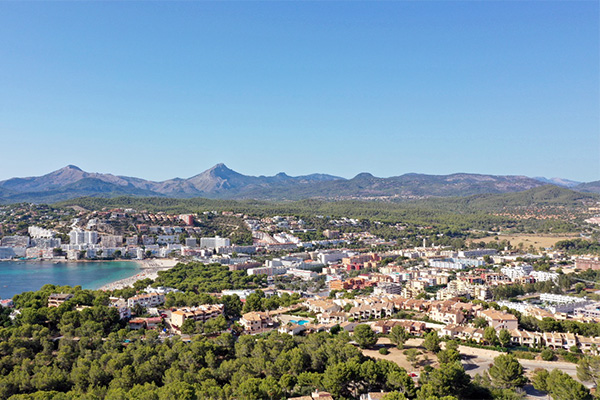
Santa Ponça (Western Mallorca)
Santa Ponça is located in southwestern Mallorca. Currently, it is an urbanization of Calvià municipality. In the Middle Ages, this territory was associated to an Islamic “alqueria” which later gave place to a “possessió”, the Mallorcan name for rural big exploitations. The name of Santa Ponça have been related to the Arab name “Sanat Busa”, which means place of reeds. This is probably related to the existence of a coastal lagoon in the area which was desiccated during the urbanization process after the touristic boom of the 20th century. This area is rich on archaeological sites, most of them included in the Puig de Sa Morisca Archaeological Park. During the 80’s, several geotechnical drillings were performed to map the extension of the wetland in relation to the Turó de Ses Beies archaeological site. OLEA-project continues this work with novel insights, methodologies and goals.
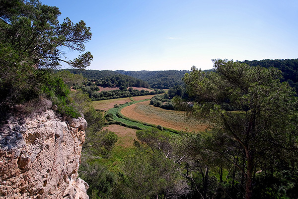
Barranc de Trebalúger (Southern Menorca)
The central part of southern Menorca is formed by incised gullies within the Miocene carbonate platform draining to the sea. Barranc de Trebalúger is one of the most important ravines, with a lagoon system in the shore. Numerous prehistoric burial caves and hypogea have been reported on the cliff-walls of these ravines, while settlements are mainly located on the upper platform. The location of cemeteries indicates that these canyons played a key role in the symbolic world of Menorcan prehistoric groups. Also, the socioeconomic importance of such ravines is attested by historical and archaeological. For instance, Andalusian colons constructed irrigation systems in these ravines for agricultural purposes during the Islamic period.